|
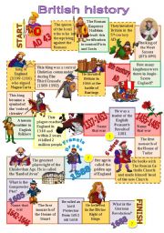
British History board game
This board game helps to revise the main events of the British history from the times of the Roman Conquest (AD 43)to the period of Glorious Revolution (1688). Students recollect the most important dates, names of Kings and Queens and events that changed the face of Britain forever. ANSWER KEY in the comments.
Level: intermediate
Age: 14-17
Type: worksheet
Downloads: 288
|
|
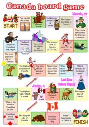
Canada board game
A fully editable board game dedicated to Canada. As usual, several categories: geography, cities, wildlife, indigenous peoples, sports, festivals, symbols... The questions aren�t that difficult but I�ll provide you with the answers for a couple of them: a famous Canadian folk singer - Stompin�s Tom Connors, RCMP stands for Royal Canadian Mountain P...
Level: intermediate
Age: 13-17
Type: worksheet
Downloads: 248
|
|
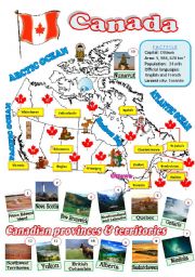
A map of Canada
A fully editable map of Canada with a factfile, the names of provinces and territories, and their capitals.
Level: intermediate
Age: 12-17
Type: worksheet
Downloads: 203
|
|
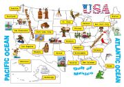
USA-map
A map of the USA. Clipart by Phillip Martin.
Level: intermediate
Age: 13-17
Type: worksheet
Downloads: 210
|
|
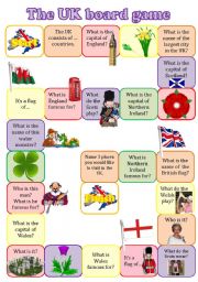
The UK boardgame
A fully editable board game to revise the main info about the UK: countries, their capitals, symbols, landmarks and the structure �TO BE FAMOUS FOR�. In a stronger class the students may not just answer the questions, but give as many details as possible.
Level: intermediate
Age: 12-17
Type: worksheet
Downloads: 178
|
|
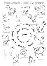
Farm animals-label the pictures
The students label thepictures of far animals using the hints.
Level: elementary
Age: 7-10
Type: worksheet
Downloads: 108
|
|
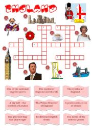
England-a crossword for young learners
The students match the definitions with the pictures and solve the crossword puzzle.
Level: elementary
Age: 9-11
Type: worksheet
Downloads: 232
|
|
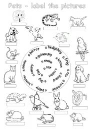
Pets-label the pictures
The students label the pictures of pets using the hints.
Level: elementary
Age: 7-10
Type: worksheet
Downloads: 122
|
|
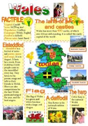
Wales-info poster for young learners
A wall poster with basic information about Wales.
Level: elementary
Age: 9-12
Type: worksheet
Downloads: 630
|
|
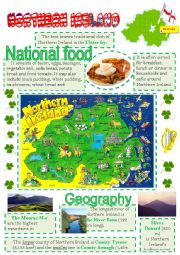
Northern Ireland - info poster for young learners - 2
The 2nd info poster about Northern Ireland.
Level: elementary
Age: 9-12
Type: worksheet
Downloads: 222
|