|
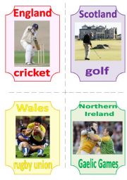
THE UK FLASHCARDS 7 - NATIONAL SPORTS
The seventh part of a set of flashcards about the UK is dedicated to national sports. Fully editable.
Level: intermediate
Age: 12-17
Type: flash-card
Downloads: 93
|
|
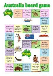
Australia board game
A fully editable board game about the Green continent (with Pillip Martin�s clipart) checks the students� general knowledge of Australia: its geography, cities, wildlife, native inhabitants, landmarks. Some questions are really challenging and require additional knowledge.
Level: intermediate
Age: 14-17
Type: worksheet
Downloads: 167
|
|
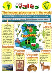
Wales-info poster for young learners-2
The 2nd part of the poster about Wales for young learners.
Level: elementary
Age: 9-17
Type: worksheet
Downloads: 359
|
|
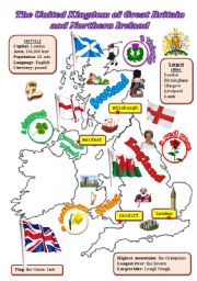
The UK: map
A fully editable map of the UK with the names of the countries, their capitals, pictures of floral emblems, flags and some icons.
Level: elementary
Age: 10-14
Type: worksheet
Downloads: 565
|
|
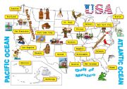
USA-map
A map of the USA. Clipart by Phillip Martin.
Level: intermediate
Age: 13-17
Type: worksheet
Downloads: 210
|
|
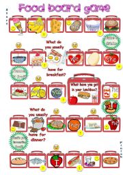
Food board game
The aim of this game is to practise vocabulary related to the topic �Food� and the structures �I, you, we they like/don�t like�, �He/she likes/doesn�t like�, �Do you/they like� , �Does he/she like?�. If the pupil lands on the picture, he/she just name the product (It�s a hamburger). If there is a smiling face, the pupil says that somebody likes tha...
Level: elementary
Age: 8-17
Type: worksheet
Downloads: 112
|
|
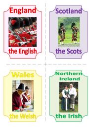
THE UK FLASHCARDS 4 - NATIONALITIES and ICONS, 2 pages, 8 flashcards
The fourth part of a set of flashcards about the UK.
Level: intermediate
Age: 12-17
Type: flash-card
Downloads: 125
|
|
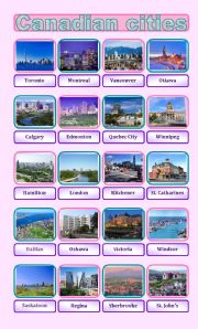
Canadian cities pictionary
20 most densely populated Canadian cities.
Level: intermediate
Age: 12-17
Type: worksheet
Downloads: 46
|
|
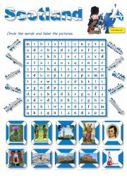
Scotland-a wordsearch for young learners
The 3rd ws of the series. The children are to lable the pictures and to find the words in the wordsearch.
Level: elementary
Age: 8-12
Type: worksheet
Downloads: 146
|
|
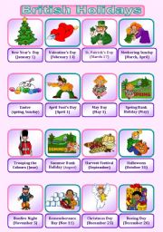
British Holidays Pictionary
Major British holidays. Phillip Martin rules the world.
Level: intermediate
Age: 13-17
Type: worksheet
Downloads: 226
|