|
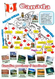
A map of Canada
A fully editable map of Canada with a factfile, the names of provinces and territories, and their capitals.
Level: intermediate
Age: 12-17
Type: worksheet
Downloads: 203
|
|
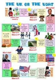
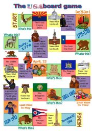
The UK or the USA-board game 2
In the 2nd game the questions are more challenging.
Level: intermediate
Age: 13-17
Type: worksheet
Downloads: 198
|
|
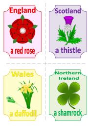
THE UK FLASHCARDS 1 - SYMBOLS and FLAGS, 2 pages, 8 cards
The first part of a set of flashcards about the UK (symbols and flags). Fully editable, so the names of the countries can be deleted and the cards can be used in various games (guess the country which this symbol/flag belong to...).
Level: intermediate
Age: 12-17
Type: flash-card
Downloads: 191
|
|
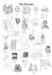
The UK icons
The teacher calls out the number and the students name the famous British icon. In a stronger class they should add as many details as possible. Answer key included.
Level: elementary
Age: 8-14
Type: worksheet
Downloads: 183
|
|
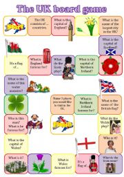
The UK boardgame
A fully editable board game to revise the main info about the UK: countries, their capitals, symbols, landmarks and the structure �TO BE FAMOUS FOR�. In a stronger class the students may not just answer the questions, but give as many details as possible.
Level: intermediate
Age: 12-17
Type: worksheet
Downloads: 178
|
|
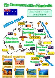
A map of Australia
A map of Australia with the names of provinces, territories, their capitals, flags, wildlife and some landmarks can be used as a visual aid while speaking about the Green Continent.
Level: elementary
Age: 10-17
Type: worksheet
Downloads: 175
|
|
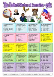
The USA - quiz
A really tough challenge! There are several categories: general info, geography, history. Some questions aren�t as easy as they seem at first sight. Answer key included, GOOD LUCK!
Level: intermediate
Age: 14-17
Type: worksheet
Downloads: 173
|
|
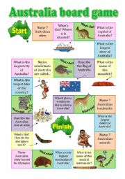
Australia board game
A fully editable board game about the Green continent (with Pillip Martin�s clipart) checks the students� general knowledge of Australia: its geography, cities, wildlife, native inhabitants, landmarks. Some questions are really challenging and require additional knowledge.
Level: intermediate
Age: 14-17
Type: worksheet
Downloads: 167
|
|
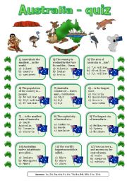
Australia quiz
A quiz about Australia. Answer key included.
Level: intermediate
Age: 12-17
Type: worksheet
Downloads: 164
|
|
The USA board game 2
ANSWERS:
Animals (green squares): bald eagle-grizzly bear-coyote-prairie dog-groundhog-buffalo.
States (pink squares): Arizona-Texas-California-New York-Washington-Ohio.
Landmarks (yelow squares): the Capitol Building-Independence Hall-Rock and Roll Hall of Fame-Guggenheim Museum-Liberty Bell-San Jacinto Monument.
People (purple squares): Abrah...
Level: intermediate
Age: 12-17
Type: worksheet
Downloads: 164
|